

Pivot Point Field App app for iPhone and iPad
Developer: Pivot Point Partners
First release : 14 Dec 2017
App size: 257.66 Mb
Pivot Point’s Field App is a native mobile application designed specifically for local government field appraisal work. The application enables field appraisers to manage their workload, easily capture and attribute images to the correct parcel, and review and update various property characteristics.
The application utilizes a cloud hosted administration site to manage users, configure datasets including importing and exporting data, and review collected data. The admin site allows the user to import a master parcel list along with 3-5 supporting attributes, like address, owner, classification, zoning, and appraised value. This information will typically come from a Computer Aided Mass Appraisal (CAMA) system export.
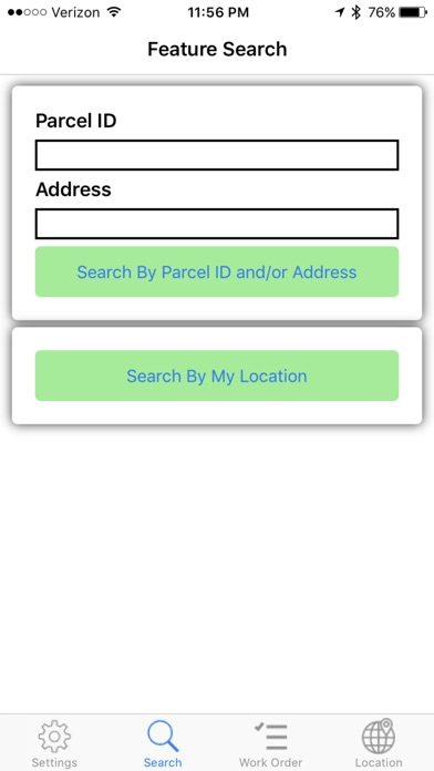
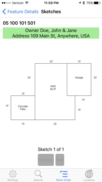
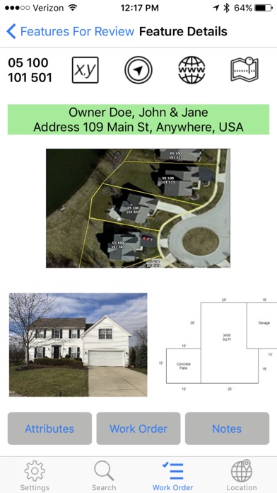
The base level app allows users to search by parcel ID, by Address, or by the user’s location. When location is selected, the app uses GPS data from the phone to find nearby parcels and then presents a list of nearby parcels sorted by the nearest proximity. Once a parcel is selected, the user can review the 3-5 attributes that were exported from the CAMA database and imported into our system. The user is also presented with hyperlink buttons to additional web based resources for additional tabular or mapping information. The user can then route themselves to the location by lat long or address search via the devices native mobile application. Once on site, the user will use the app to take a picture of the property, at which time the location and heading are captured. Once the image is taken, the user will be prompted to choose the structure type (residential, commercial, industrial, etc), add text descriptions, as well as if the new image will be the primary image or not. Notes can also be taken on a parcel level.
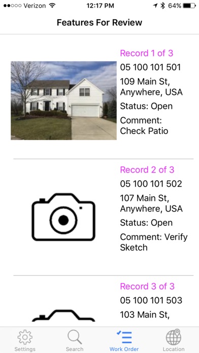
The advanced level app includes Work Order functionality. This allows the user to select a list of parcels that to be field reviewed (typically 25-50 parcels). These parcels will typically be selected in the CAMA system through a custom selection and export. The export will include more fields and supporting data over the basic level 3-5 attributes. The end user will upload the exported work order data via the admin site and assigned to any username in their group. Users can also manually search and assign parcels to work orders, adding notes for the reviewer, as well as a priority/ranking order.
While the app does include some functionality that requires internet connectivity (live routing, additional hyperlinked web resources, and interactive mapping), the core functions of the app are designed for offline use. The user will download all data assigned to their account while in the office using Wi-Fi. Once they return from their field work, they will use the upload button to upload all images, notes, and attribute edits to our cloud instance. That data will then be exported and imported back into the users CAMA system.